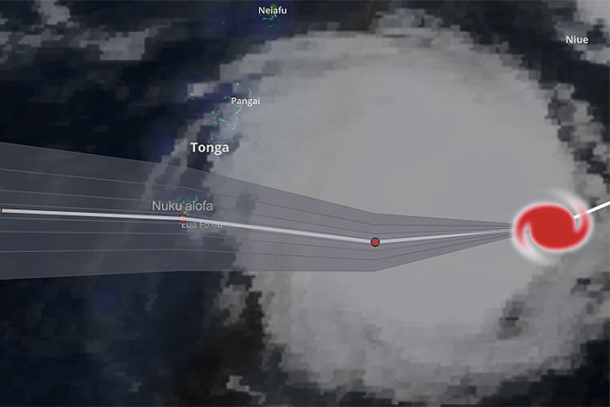
The latest forecast for Tonga is not something you want to see - a forecast for already Category 4 Severe Cyclone Gita to reach Category 5 status (the highest on the scale) and make a direct hit over the top of Tonga and the capital Nuku'alofa on the main island Tongatapu tonight and early Tuesday.
Over 75,000 people are in the path of a storm already more powerful than anything New Zealand has ever seen with torrential rain and damaging winds forecast to be averaging close to 200km/h and gusting over 230km/h by tonight when it makes landfall there.
"Maximum wave heights could be in excess of over 10 metres with storm surge at the centre of the cyclone lifting the sea up even further leading to coastal inundation and sending those waves even further inland," says WeatherWatch.co.nz
"These incredibly dangerous seas could last 24 hours aroud the southern islands of Tonga."
The most severe portion of wind and rain at the centre of the low will last around 12 to 18 hours over Tongatapu, says the weather organisation.
"Powerful cyclones do tend to wobble at times from the forecast tracking. A last minute jog to the south could have significant benefits to Tonga, but a jog to the north could make things worse.
"These 'wobbles' are unpredictable, as we saw with Category 5 Cyclone Winston in 2016 which at the last hour wobbled off the forecast track and ended up making landfall in Fiji instead of remaining just out at sea.
"By Tuesday afternoon conditions should be calmer in Tonga weatherwise, although dangerous seas and more normal rain could linger through Wednesday.
"Computer modelling agrees that a direct hit to Tonga from the centre of Gita looks highly likely in the main southern island of Tongatapu overnight tonight.
"With the island being so small, there is a chance Gita won't technically make landfall (when the centre crosses land), but even a close brush will be equally as damaging."
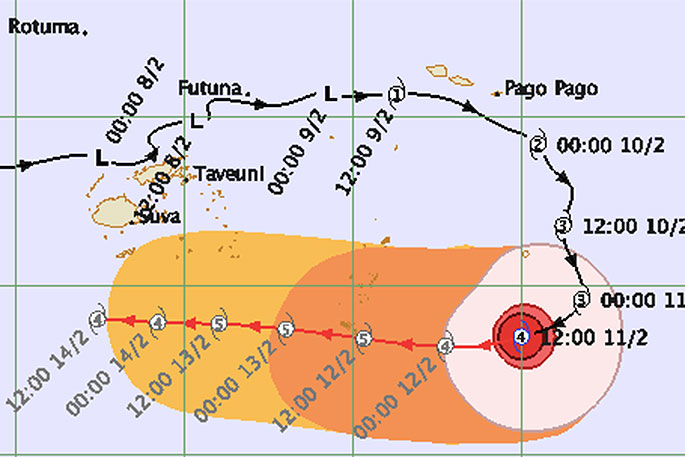
Tracking from JTWC (US Government)
WHAT HAPPENS AFTER TONGA?
Beyond Tonga the computer models remain divided, says WeatherWatch.co.nz
"They do agree Gita will remain a powerful Cat 5 or Cat 4 storm for the days ahead and track westwards, but they don't yet agree when the storm will start to turn south into the Tasman Sea.
"Norfolk Island (Australian territory just to the north west of New Zealand), still runs a risk of a direct hit but even New Caledonia (French territory) much further north could be exposed - highlighting the uncertainty about the future precise tracking of this storm and this will affect when we can be more detailed about how New Zealand might be impacted."
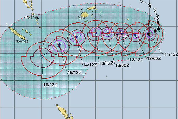
Tracking by the Fiji Met Service.
WeatherWatch.co.nz says there is increasing confidence New Zealand will be affected by Cyclone Gita but it is still too early to lock in the intensity or timing.
"Reliable models are showing the storm reaching New Zealand anywhere from this Sunday to next Wednesday with varying intensity.
"Many of you are seeing the various models in the public domain, some show a direct hit to New Zealand this Sunday while others show the storm almost reaching Australia before curving back towards New Zealand next Wednesday.
"So this large uncertainty means we should definitely keep the focus on Tonga for the next 24 hours.
"The last Category 5 cyclone in the South Pacific to make landfall was Cyclone Winston in 2016 which hit Fiji."
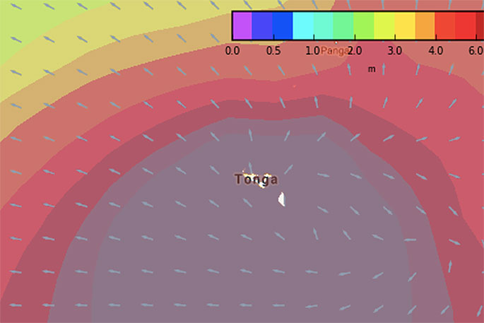 Swell map for 1am Tuesday shows major swells and waves, over 10 metres which will cause coastal inundation in some areas / MetOcean.
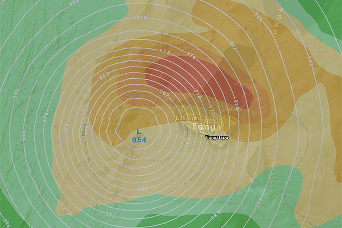
ECMWF (Europe) computer modelling showing the centre of Gita passing over Tonga late tonight and in the early hours of Tuesday.
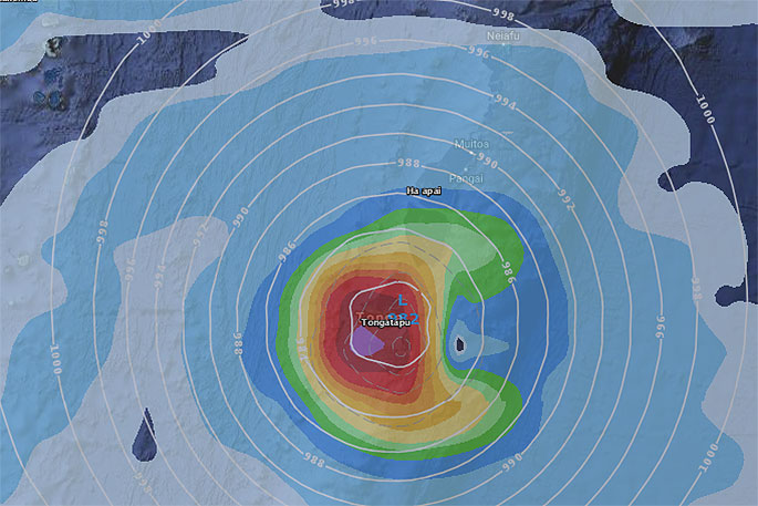
GFS (US Government) agreeing with ECMWF about where the centre of Gita will track overnight tonight in Tonga.

1 comment
and
Posted on 12-02-2018 15:22 | By Capt_Kaveman
after 30 years they have learned nothing and rebuilding straw houses will just be a waste of time
Leave a Comment
You must be logged in to make a comment.