The Bay of Plenty, Auckland and Northland regions are expected to be hammered by rain in the second half of this week.
The generally dry weather over the weekend carries into the start of this week with just a few showers taking the shine off the sun until Wednesday.
'A settled beginning to the week will be welcome news for those heading to the next big rugby clash in Hamilton Tuesday night. Conditions are looking good for players and spectators alike,” says MetService meteorologist April Clark.
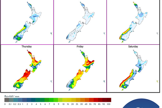
'Not only does Wednesday mark the shortest day of the year, but it also sees the start of a deterioration in weather over country. The upper North Island and west of the South Island succumb to the rain first, as a complex low in the north Tasman Sea sinks south.”
On Thursday, the whole country surrenders to the low.
The worst rain-affected areas are forecast to be Bay of Plenty, Auckland and Northland, with gale northeasterlies also expected in exposed places.
In addition, heavy rain is possible for other areas from Canterbury northwards on Thursday or Friday.
As the low continues to track south on Thursday, a cold front comes into play in the lower South Island, bringing a southerly change and a forecast for snow down to 500 meters at this stage.
This front is absorbed by the low as it moves across New Zealand on Friday, keeping most of the country wet – ironically, the West Coast and Fiordland currently look like the driest places for the last day of the working week.

0 comments
Leave a Comment
You must be logged in to make a comment.