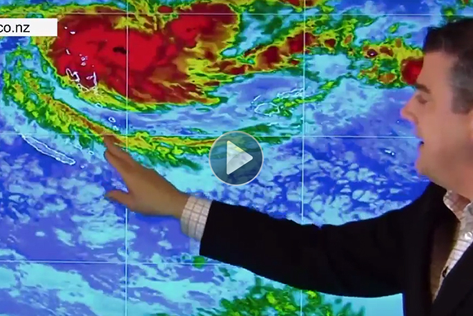
Cyclone Donna formed overnight and is already a Category 2 tropical cyclone and is expected to reach Severe Cat 3 status, with winds average 200km/h and gusting much higher.
In this special update, WeatherWatch.co.nz tracks both the upcoming weekend weather and the sudden development of Cyclone Donna which is about to hit Vanuatu, likely as a "severe" cyclone over a number of days.
'Meanwhile at the same time in New Zealand we're dealing with an incoming anti-cyclone for Friday, the weekend and early next week,” says head forecaster Philip Duncan.
In the video below, Phillip tracks what might happen next week as the remnants of then ex-Cyclone Donna possibly link up with a low in the Tasman Sea.
The long range forecast is by no means locked in, but here's the latest on how the next several days may shape up in our part of the world.
The weather pattern around New Zealand is a neutral one at the moment - in other words, it encourages more chaos and that's precisely what we're seeing with major rain makers followed by big strong highs.
Lately there hasn't been too much of the ‘high pressure variety' for everyone's liking, but the next four days or so look to be fairly settled in New Zealand as a high (also known as an anti-cyclone because the winds spin anticlockwise in the Southern Hemisphere) is moving in.
Friday and Saturday will have cool mornings but the afternoons should be a little milder than the past couple of days.
Highs don't always bring sunny weather, especially not in the cooler darker months of autumn, winter and early spring.
Latest satellite images suggest there may be some of that ‘anticyclonic gloom' possible in the western regions too (low cloud trapped under the high) as it's currently lying under the high out over the Tasman Sea.
About 90 per cent of New Zealand looks dry over the next three or four days, with coastal cloud and showers most likely and winds easing in the eastern regions of the North Island by Saturday.
Sunniest weather will be inland across both islands, also the east of the South Island.
The high will remain in charge until Tuesday when it slides east and is replaced by a Tasman Sea low and then, possibly (about a 70 per cent chance at this stage) the rainy remnants of Donna as the then ex-cyclone falls apart as it leaves the tropics heading south.
It's this big high that is coming in now that may cause the heavy rain over New Zealand to stall later next week, with the high effectively acting as an invisible brick wall to our east.

0 comments
Leave a Comment
You must be logged in to make a comment.