As we approach our second cold snap this week it may be hard to focus on a potential tropical event in 10 days time - especially when it may not even pan out, warns WeatherWatch.co.nz.
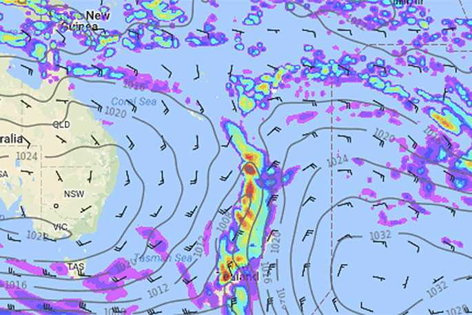
'Reliable computer models are picking an interesting set up that could produce a narrow but tropical line of very heavy slow moving rain over the country at the end of next week.
'A set up like this - where you have a vein of tropical rain stuck between two highs has, in the past, created flooding conditions over localised parts of the North Island. In fact the flooding and huge rain totals we saw in March in Auckland, Waikato and Coromandel Peninsula was caused in part by a set up like this.”
The rain may also contain an ex-tropical storm and an ex-Tasman Sea low - which may encourage heavier downpours.
It also may be follow by the third cold snap in 10 days for New Zealand (although this 3rd cold snap may be more South Island focused).
'With the North Island wetter than average any tropical rains will be an issue - so we'll keep you posted,” says the weather organisation.
'Remember, it's still a very long way out, so we do expect things to change in the forecast models - but a few of you have asked us about this possible set up so we wanted to cover it as best as we can this far out. Check back for more updates in the coming week.”

1 comment
Admire their honesty
Posted on 02-05-2017 16:26 | By Papamoaner
Extrapolations by humans or computers are not always correct, so let's not blame the Met guys if it doesn't happen. They are doing the right thing by warning us it COULD happen again.
Leave a Comment
You must be logged in to make a comment.