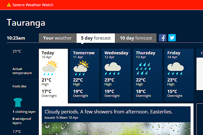
UPDATED 10.27AM: A severe weather watch has been issued for the Bay of Plenty, with heavy rain expected to move into the region on Wednesday.
A low is expected to move southeast over the Tasman Sea on Tuesday and Wednesday. Its associated front should bring periods of heavy rain to the west of the South Island on Tuesday, spreading to Taranaki and Bay of Plenty on Wednesday.
"This watch is for the possibility of heavy rain reaching warning levels over Westland, Buller and northwest Nelson during Tuesday and over Taranaki and Bay of Plenty on Wednesday," says a statement from the MetService.
"The heavy rain over Bay of Plenty is likely to continue into Thursday."
Further to this system, the remains of tropical cyclone Cook may pass close to or east of the North Island late in the week and MetService meteorologists will continue to moniter the development of this cyclone.
"People in these areas should stay in touch with the latest forecasts in case any of these areas are updated to a full warning or further areas need to be added to the watch."
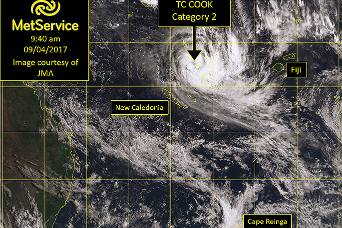
Tropical Cyclone Cook, category 2, near Vanuatu on Sunday morning. Image: MetService.
Sunny and dry weather prevailed in many regions that were recently affected by flooding in the weekend.
An area of high pressure to the east of New Zealand maintains generally settled weather to start the new week, but significant rainfall is signalled for some regions later in the week, including the Bay of Plenty.
Under clear skies and with light winds some chilly starts have been notable this weekend.
'There have even been some frosts in inland places. The temperature on the Desert Road dropped to -0.6C on Sunday morning, while Manapouri awoke to a misty -0.3C,” says MetService meteorologist Peter Little. Meanwhile, the tropics have remained active and Tropical Cyclone Cook was named near Vanuatu around midnight Saturday.
The now category 2 cyclone is expected to track southwards over New Caledonia during Monday, then move slowly southeastwards.
'At this stage the computer models we survey are showing a range of possible tracks, so it's unclear whether the cyclone will come to New Zealand,” says Peter.
'However, regardless of whether the cyclone heads our way or not, it is likely that a moist northeasterly flow between the tropics, another low over the Tasman Sea and a large high east of New Zealand will bring significant heavy rain to parts of the country later this week.
'This includes some regions still mopping up after last week's flooding.”
TROPICAL CYCLONE COOK
A depression near Vanuatu was named Tropical Cyclone Cook in the early hours of this morning (NZST).
At 9am yesterday, it was a category 2 cyclone with maximum winds of 90km/h close to the centre. As it tracks slowly southwards today it is expected to intensify into a category 3 cyclone, with winds rising to 120 km/h near the centre.
The Tropical Cyclone Warning Centre in Fiji is currently responsible for issuing warnings on the system, and expect TC Cook to cross New Caledonia during Monday, then track slowly southeastwards.
Beyond this time there remains considerable uncertainty as to the track of the cyclone, but rest assured that MetService Meteorologists are monitoring TC Cook closely and will keep you up to date with any potential impacts on New Zealand.

0 comments
Leave a Comment
You must be logged in to make a comment.