UPDATED 10.04AM: The severe weather watch issued for the Bay of Plenty has been upgraded to a warning.
Heavy rain and strong winds are expected to lash the region, with rainfall totals predicted to exceed 200mm in some areas.
The severe weather is being brought about by a deepening low over the Tasman Sea.
The low directs a moist northerly flow onto the North Island and a slow moving trough is expected to lie over the central North Island, says the MetService.
"The low is forecast to cross central New Zealand early Thursday, and both the low and trough move away to the east and southeast.
"Heavy rain is already falling in many places, especially in the vicinity of the trough, and is expected to continue until the passage of the low and trough early Thursday morning."
Regions from Northland to Taranaki, including Coromandel Peninsula, Bay of Plenty, the central plateau, Gisborne, Hawke's Bay and Wairarapa are expected to recieve the largest rain accumulations.
This is a significant amount of rain and people are advised to watch out for rapidly rising rivers and streams, flooding and slips.
EARLIER:
 Weatherwatch.co.nz meteorologist Philip Duncan.
If you look outside today, it's pretty clear that the rain forecast earlier this week has arrived.
A severe weather watch issued for the Bay of Plenty yesterday remains in place today as a deep low crosses over the country.
'A deepening low is going to move over New Zealand, containing loads of tropical moisture left over from the remnants of Cyclone Debbie,” says the MetService.
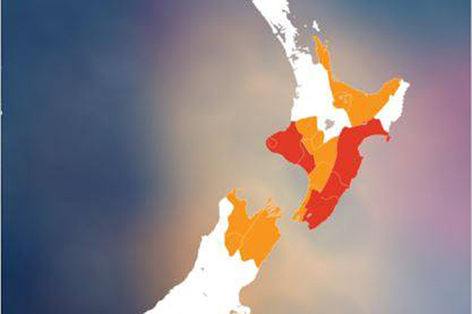 The orange indicates regions where watches have been issued and red is for warnings. Image: MetService.
'Strong winds are expected in many areas too, but please note that this weather system bears very little resemblance to a tropical cyclone other than the fact that it contains lots of very humid air from the tropics that brings the potential for heavy rain.”
According to Weatherwatch.co.nz, a low drops out of the Tasman Sea moving closer to New Zealand as Wednesday ticks along, this brings unsettled weather with heavy rain to many regions.
'This low passes out to the east of the country on Thursday and the airflow changes around to the southerly quarter for the South Island, westerlies for the North Island,” says a statement on the weather organisation's website.
Want to know more about the rain event hitting the area at the moment, watch the video below.

3 comments
stupid
Posted on 04-04-2017 16:41 | By dumbkof2
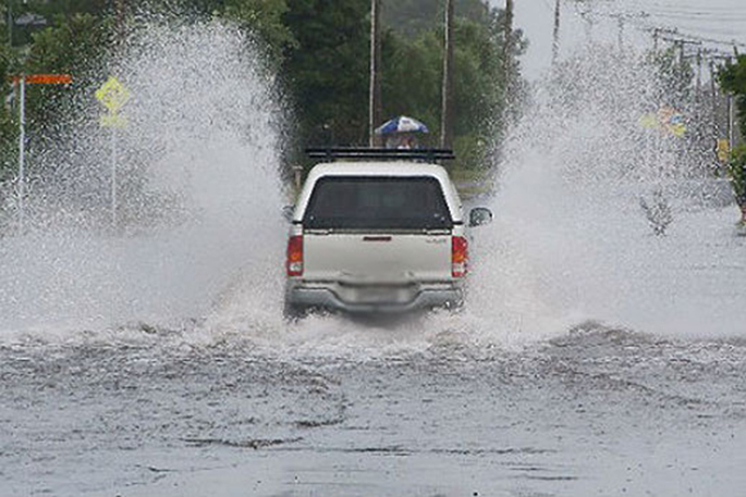
what an idiot going through floodwater at this speed dont know what is under the surface. and what about the wake they cause damaging other property. they would be the first to complain if someones wake damaged their property. just use a few brains and slow down in floodwaters.
Idiot
Posted on 04-04-2017 18:34 | By sangrae
Why would you blank his rego plate out obvisouly you do not condone his behaviour,it is not only dangerous but stupid behaviour.
You can...
Posted on 04-04-2017 19:39 | By Me again
call them stupid all you like the next one will be going faster to get the 'wake' affect. And brains?? what are those. They sit on them me thinks... My truppence worth!!!
Leave a Comment
You must be logged in to make a comment.