
UPDATED 2.52PM: An energetic low over the Tasman Sea is expected to direct large amounts of moisture originating from the tropics onto New Zealand.
In other words, a lot of rain is expected to fall in the area.
The heaviest rain is expected over much of the North Island and the upper South Island, associated with a slow moving trough.
"Very strong southeasterly winds are expected to the south of this trough and these winds could rise to severe gale," says a statement from the MetService.
"The low is likely to move off to the east on Thursday."
On Wednesday there is a high risk of rainfall accumulations reaching warning amounts in Waikato, Bay of Plenty, Rotorua, Waitomo, Taupo, Taranaki, Taihape, Manawatu, Horowhenua Kapiti Coast, Wellington, Wairarapa, Nelson, Marlborough and the far north of Canterbury as indicated on the chart.
There is a moderate risk of heavy rain over a broader area including much of the remainder of the North Island, Buller and much of Canterbury.
"On Wednesday, there is also a high risk of severe southeasterly gales in Manawatu , Horowhenua Kapiti Coast, Wellington, Marlborough, Nelson, Buller and Westland.
"There is a moderate risk of severe northerly gales in Taranaki,Wanganui and Taihape."
On Thursday there is a moderate risk of heavy rain in the east of Otago and the far south of Canterbury as indicated on the chart.
There is a low risk of severe southwesterly gales about coastal Otago and the Banks Peninsula.
EARLIER:
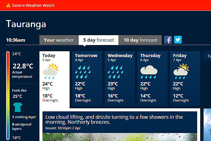
Low lying cloud, aka fog, blanketing the Bay this morning has lifted letting some sun shine over the region.
The MetService warns that the sun could be short lived and has issued a severe weather watch for heavy rain.
A watch is currently in place for the Bay of Plenty, Waitomo, Coromandel, Rotorua, Taumaranui, Taihape, Hawke's Bay, Tararua, Wairarapa, Taranaki, Wanganui, Manawatu, Kapiti Horowhenua, Wellington, Marlborough, Nelson and Buller.
'A deepening low pressure system over the Tasman Sea approaches northern New Zealand on Tuesday, then crosses the country during Wednesday and Thursday, followed by a ridge of high pressure on Friday,” says a statement from the MetService.
'This deep low should bring heavy rain to many parts of the country, especially from central North Island to the top of the South Island from Tuesday to Thursday, with strong winds at times.”

0 comments
Leave a Comment
You must be logged in to make a comment.