
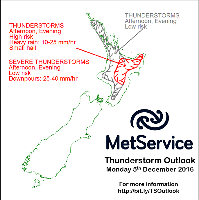
Thunderstorms are likely for the Bay of Plenty this afternoon as the day heats up.
The MetService says there is a low risk of thunderstorms in the Western Bay of Plenty, but there is a severe risk in the Eastern Bay.
The North Island will also see some sunny breaks, but showers are expected to pop up across the Island as the day heats up, says meteorologist Claire Flynn.
'Onshore sea breezes are expected around the North Island. As the day heats up, these sea breezes converge.
'Warm, rising air lifted by the convergence will cause showers across the North Island on Monday.
'Some of the showers will be heavy, particularly inland, and thunderstorms are likely for inland Bay of Plenty, Taupo and Taihape, as well as the ranges of Hawkes Bay and Gisborne.”
On Tuesday, a trough moves onto the South Island, bringing rain with some heavy falls to the west, and thunderstorms are possible. The trough brings scattered rain into eastern areas, mostly on Wednesday.
'This complex trough moves very slowly northwards during Wednesday and Thursday. It reaches the North Island on Thursday, bringing a period of rain, with some heavy falls possible for central areas,” says Claire.
'Meanwhile, a ridge of high pressure moves onto the South Island at the end of the week.”

0 comments
Leave a Comment
You must be logged in to make a comment.