Scorching temperatures are being predicted for parts of New Zealand this week – but it looks like the south is going to be the hotter of the two islands.
The MetService is predicting temperatures of 30 degrees in Christchurch and Ashburton, but in the Bay, the daily high is set to reach 20.
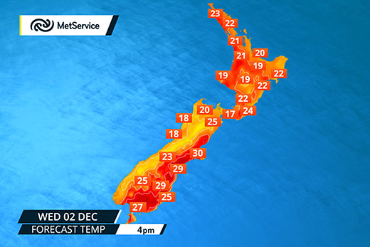
Summer warmth? Some South Island spots are expected to hit 30 degrees today. Photo: MetService, via Twitter.
The current extremes on the MetService website show Timaru sitting at 27.2 degrees, while Rotorua is registering 14.6.
Wellington is currently the windiest city in the country, with winds of 30km/h hitting the region.
MetService meteorologist Tom Adams says a warm and moist tropical air mass is moving across the country from the north-west.
'The east coast [of the South Island] quite often at this time of year gets those north-west winds, which will raise temperatures,” says Tom.
'What's notable is the north-westerly is particularly warm and moist, which means there's more rain, more latent heat and warmer in the east.
'It's a warm tropical air mass, but there's a cold front starting to approach the South Island. That will bring a change.”
An active front, preceded by a north-west system, is expected to move north-east across the South Island on Thursday then weaken and roll slowly across the North Island on Friday and Saturday.
Over the past few months the El Nino Cycle has ranked as one of the strongest in years and has yet to reach its peak.
Modelling suggests the peak will be around mid-December, with more high pressure systems over the North Island and north-westerly systems in the South Island, which could lead to a dry and drought-prone summer.

0 comments
Leave a Comment
You must be logged in to make a comment.