This video was shot by Isso Nihmei and put on YouTube showing the destruction of Cyclone Pam.
Tropical Cyclone Pam has been severely affecting Vanuatu this morning with the centre passing just east of the capital city, Port Vila on the island Efate. ‘
One person has been confirmed dead in Papua New Guinea, reports Stuff.
Watch the latest MetService video at the bottom of this story.
Pam has now moved south-southeast to the islands Erromango and Tanna.
It is expected to lie just south of Tanna this afternoon, says MetService meteorologist Hordur Thordarson.
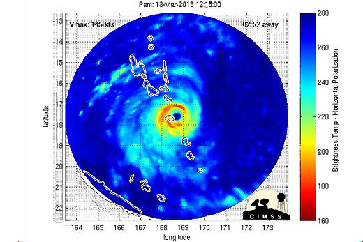
'This is one of the most intense storms on record with a central pressure estimated at near 890 hectoPascals and sustained winds of around 250 kilometres per hour near the centre.
'Winds of this strength have the potential to cause catastrophic damage with dangerous flying debris and structural destruction.”
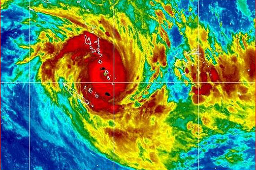
Infra-red image from 7.32am.
South of Vanuatu, TC Pam should be affected by a north-westerly flow at upper levels.
This flow should steer Pam onto a south-easterly track that should bring it into the area northeast of New Zealand on Sunday.
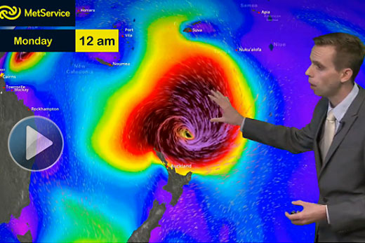
Snapshot from the animation, showing the tropical cyclone early this morning as the centre passed just east of Efate in Vanuatu, on course towards the islands to the south-southeast.
There is still some uncertainty with respect to the track, so people are advised to keep up with the latest forecasts, watches and warnings on our webpage, www.metservice.com, says Hordur.
'Cyclone Pam is expected to have a large impact in New Zealand. A warning for heavy rain has been issued for Gisborne, the northern Hawkes Bay ranges and the ranges of Eastern Bay of Plenty. A warning for severe gales has been issued for the Bay of Plenty, especially in the east and for Gisborne.
'Watches for severe gales have been issued for a broader area including Northland, Coromandel, Great Barrier Island and northern Hawkes Bay. A watch for heavy rain has been issued for Eastern Northland and Coromandel including Great Barrier Island.”
The watch is also an alert for dangerous coastal conditions over the east coast of the North Island from Cape Reinga to Wairarapa.
Sea conditions are expected to become extremely dangerous on the north and east coasts of the North Island.
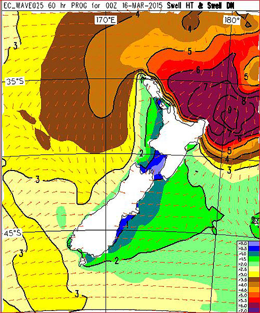
This is a map showing swell height in metres at midday on Monday. This swell is exceptionally large, especially in Gisborne and the Bay of Plenty where it could be about 7 metres. This is likely to lead to widespread coastal erosion. Anyone considering venturing near or into the water should take extra precautions and be sure to check the latest forecasts for expected dangerous conditions.

0 comments
Leave a Comment
You must be logged in to make a comment.