Port of Tauranga approaches could in future be marked by AIS virtual beacons that set off bridge alarms if ships turn towards danger.
Since the containership Rena struck the unmarked Astrolabe Reef on October 5, 2011, the regional council has been considering ways to reduce the risk of ships grounding in the region, including virtual aids to navigation.
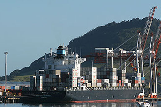
Ships come in and out of the Tauranga Harbour every day.
'The approach to the Port of Tauranga has a number of underwater hazards lying near shipping routes, including Astrolabe Reef, Brewis Shoal, Okapara Reef, Penguin Shoal and Tuhua Reef,” says Bay of Plenty Regional Council maritime operations manager Reuben Fraser.
'Western Bay of Plenty harbourmaster Jennifer Roberts is proposing requiring all vessels more than 500 gross tonnage or longer than 40 metres to keep more than two nautical miles off land and charted dangers, or any outlying islands in the Bay of Plenty. These restrictions won't apply to recreational vessels.
'We've identified that a virtual aid to navigation could be a possible solution to marking these five identified hazards, since it would be really difficult to physically mark the reefs.”
The council is looking at a system that links with ships' AIS, Automatic Identification System, is required on all ships over 300 tonnes. The Rena had one.
The Virtual AIS Beacon is created by sending a signal from one location to mark a remote point. The remote point displays on the ship's chart plotter, AIS display or other receiving equipment.
An AIS transceiver can also be placed on buoys. The buoy marking the underwater Tarapunga Rock near the entrance to Doubtful Sound, was unable to survive seven metre seas. The rock is now the site of the country's first virtual AIS beacon, a system that can also work for Astrolabe Reef - Schooner Rocks, Brewis Shoal, Okaparu Reef, and other local hazards awaiting the next Rena.
The Tarapunga Rock transmitter is located on nearby Secretary Island. The Astrolabe Reef transmitter could be located on Motiti Island. Cruise ships entering Doubtful Sound can now identify Tarapunga Rock from ten nautical miles out to sea, and about two nautical miles when travelling down the down towards the Tasman Sea.
It would mean that when the Rena's navigation officer altered course ten degrees to port about 1.30am on October 5, steering the ship directly at Astrolabe Reef, a virtual AIS beacon would have tripped the ship's collision alarm while ship was still 20 miles away and in plenty of time to make a turn.
A virtual marker is transmitted from an Automatic Identification System station, and will alert both the ship and the Regional Council that the vessel is heading towards a charted danger, or enters the no-go zone around each hazard.
'The virtual markers would help the Regional Council with monitoring and enforcement of exclusion zones like these.
'By providing for safer commercial boating we're also helping to keep businesses that rely on the Port operations booming. However regardless of the warning systems that we have in place, if mariners ignore them incidents can still occur,” says Reuben.
'It would be beneficial if the system could also collect data on traffic movement in the region. This would give us more information on how the region is used and enable Council to manage shipping traffic more safely.”
Tenders close for the virtual marker system on 3 July.
The country's first virtual beacon is a development by Auckland company Vesper Marine which has received multiple international technology and innovation awards for the virtual beacon.

0 comments
Leave a Comment
You must be logged in to make a comment.