UPDATE: Severe thunderstorms are now being forecast as a complex trough moves over the country.
The MetService has issued a severe thunderstorm watch for Northland, Auckland, Great Barrier Island, Coromandel Peninsula, Waikato and Bay of Plenty.
"An active front is forecast to move eastwards over northern New Zealand tonight and Friday morning, bringing a period of heavy rain.
"Thunderstorms are also possible, and this Watch is an alert to the potential development of severe thunderstorms that could produce localised downpours of 25 to 40 mm/h in Northland, Great Barrier Island, Auckland, Coromandel Peninsula, Bay of Plenty north and west of Tauranga, and eastern Waikato near the ranges. Note, these downpours could occur with or without thunderstorms.
"Rainfall of this intensity can cause surface and/or flash flooding, especially about low-lying areas such as streams, rivers or narrow valleys, and may also lead to slips.
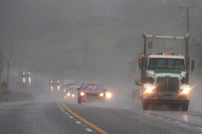
"Driving conditions will also be hazardous with surface flooding and poor visibility in heavy rain."
EARLIER:
A severe weather warning for heavy rain and strong winds is now in place for the Bay of Plenty and Coromandel Peninsula.
The MetService says heavy rain and northerly gales are forecast for much of the South Island and parts of the North Island, including significant heavy rain for Westland and Southland.
"A complex trough of low pressure over the Tasman Sea is moving slowly towards New Zealand, while an associated front moves over the South Island overnight tonight and over the North Island during Friday.
"A humid northerly flow precedes the front, and is expected to bring periods of heavy rain and strong north to northeast winds to many places.
"Large waves are also expected to affect the west coast of the South Island. A cooler southeasterly flow behind the front is bringing heavy rain to the far south of the South Island.
"This continues to be a significant event for Westland. People should listen to advice from local authorities, and those who need to travel through the region need to take extra care.
"Additionally, a significant amount of rain is expected in Southland and localised flooding is likely, especially in the west.
"People are advised to keep up to date with the latest forecasts."
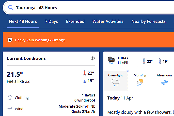 Image: MetService.
Heavy Rain Warning - Orange
Heavy rain may cause streams and rivers to rise rapidly. Surface flooding and slips are also possible and driving conditions may be hazardous.
Area: Coromandel Peninsula
Valid: 12 hours from 3am Fri 12 Apr to 3pm Fri 12 Apr
Forecast: Expect 80 to 120 mm of rain in parts of the region. Peak rates of 20 to 30 mm/h likely in localised downpours Friday morning, with thunderstorms also possible.
Please note, a Severe Thunderstorm Watch will be issued later this morning for this region.
Area: Bay of Plenty, including Rotorua
Valid: 19 hours from 4am Fri 12 Apr to 11pm Fri 12 Apr
Forecast: Expect 80 to 140 mm of rain in parts of the region, especially about and east of Rotorua. Peak rates of 20 to 30 mm/h likely in localised downpours Friday morning and afternoon, with thunderstorms also possible. Heavy rain easing west of Whakatane Friday late afternoon and early evening

0 comments
Leave a Comment
You must be logged in to make a comment.