R/V Tangaroa sets sail on the final voyage to complete a picture of the volcanic plumbing systems of Whakaari/White and Tūhua/Mayor island volcanoes as part of the GNS-led Beneath the Waves programme.
An in-depth picture of the subsurface of these nearshore volcanoes will help scientists understand the triggers, hazards and impacts of potential volcanic events including, ashfall, pyroclastic flows of hot ash and gas, landslides and tsunami.
Scientists from GNS Science, Scripps Institute of Oceanography as well as two BLAKE GNS Ambassadors will deploy the last 39 of 200 Ocean Bottom Electromagnetic sensors from March 28 to April 12 to image the magmatic plumbing systems feeding the mostly submerged volcanoes as well as identify areas of active hydrothermal venting.
Findings from the three previous voyages have already provided new insights into the frequency, size and drivers of past eruptions, says GNS Science Senior Volcano geophysicist and programme leader Craig Miller.
“Early analysis of subsurface imaging of the crust indicates evidence for deep fluids, possibly magma, to the northwest of Whakaari,” says Craig.
“If correct, the location of this offset magma reservoir could have implications for how we monitor this volcano in the future.
“These fluids occur close to an area of active faulting so monitoring seismic activity in this area could signal an increased level of volcanic activity.
“Preliminary results from seabed sediment samples also suggest larger eruptions in the last few thousand years compared to eruptions we know from records extending back to the 1800s.
“We now want to investigate whether these eruptions were large enough to deliver ash to the mainland.”
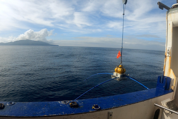
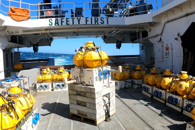 OBEM sensor on the RV Tangaroa. Photo credit: Jenny Stein GNS Science.
Data from autonomous underwater vehicle surveys carried out on a previous voyage have identified locations of previous hydrothermal activity and active underwater seeps of hydrothermal fluids.
These complement airborne surveys flown in early 2023 using the SkyTEM system and inform mapping of past and present hydrothermal activity over the full extent of the volcano.
These data are used to build accurate 3-D models that indicate areas of weakened rock and where past episodes of flank collapse have occurred.
This is important as flank collapses (landslides from steep volcanic topography) could trigger an eruption or cause a tsunami.
“The subsurface imaging is contributing to robust numerical simulations and models that we are starting to use to assess multiple possible scenarios for the Bay of Plenty from future volcanic events,” says Craig.
“If we can determine the probability and impacts of these volcanic hazards, we can better prepare for them when they occur.”
Beneath the Waves is a GNS-led MBIE Endeavour programme delivered with collaborators from University of Canterbury, Massey University, Victoria University of Wellington, East Coast Labs and Bay of Plenty Civil Defence and Emergency Management.

0 comments
Leave a Comment
You must be logged in to make a comment.