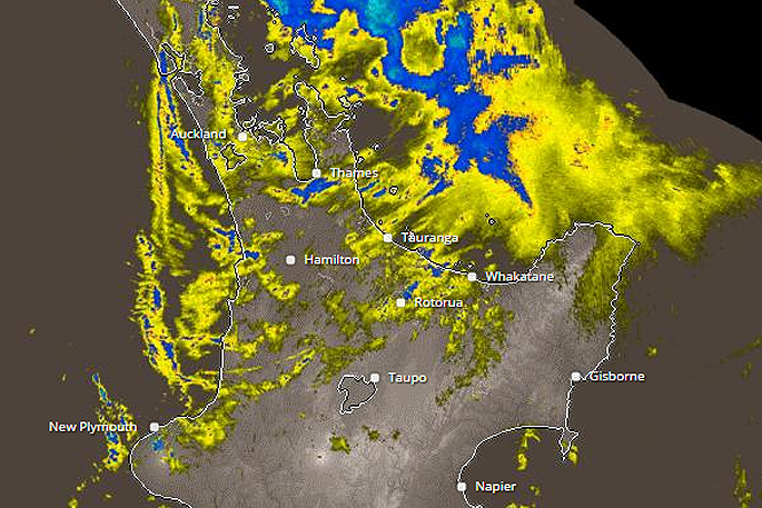
A severe weather warning has been issued for Northland, Eastern Bay of Plenty and Nelson with predictions of heavy rain for those regions.
An active front over Northland is forecast to move slowly eastwards across the upper North Island today, before moving away to the east tonight.
'An associated deep low should then cross central New Zealand during Thursday morning,” says the MetService.
'These weather systems are forecast to bring heavy rain to northern and western parts of both islands.”
The heaviest falls are expected about the eastern hills of Northland and Bay of Plenty east of Whakatane, where up to 90mm is possible, and also northwest Nelson where 100 to 140mm is likely about the ranges.
'People in these areas are advised to look out for rapidly rising rivers and streams and also possible slips and surface flooding.”
HEAVY RAIN WARNING
AREA/S AFFECTED
Eastern hills of Northland
FORECAST
Heavy rain is expected to continue tonight (Tuesday) and overnight, then to ease late Wednesday morning. In the 12 hours from 9pm Tuesday to 9am Wednesday, expect 60 to 90mm of rain. Peak intensities of 20 to 30mm per hour are possible.
AREA/S AFFECTED
Bay of Plenty east of Whakatane
FORECAST
Rain is forecast to become heavy Wednesday morning and then to ease Wednesday evening. In the 12 hours from 9am to 9pm Wednesday, expect 70 to 90mm of rain to accumulate about the ranges, with lesser amounts near the coast. Peak intensities of 15 to 25mm per hour and thunderstorms possible.
AREA/S AFFECTED
Northwest Nelson
FORECAST
Rain becoming heavy for a time Wednesday morning and then again from Wednesday evening to Thursday morning. In the 28 hours from 2am Wednesday to 6am Thursday, expect 100 to 140mm mainly about the ranges. Peak intensities of 20 to 30mm per hour are expected for a time Wednesday morning and again from Wednesday evening.
FREEZING LEVEL: 2800 metres

0 comments
Leave a Comment
You must be logged in to make a comment.