New Zealand's geo-hazard monitoring system is celebrating its 15th birthday this year, says GeoNet.
It came into service in July 2001 when the Earthquake Commission entered an agreement with GNS Science to substantially upgrade and expand New Zealand's geo-hazard monitoring networks, which are operated by GNS Science.
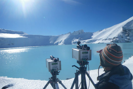
GeoNet monitoring on Mount Ruapehu's craterlake. Photo: Supplied.
EQC initially stumped up $5 million-a-year for 10 years to fund what has become an international leader in national hazard monitoring networks. The Commission's funding support subsequently increased to $8 million-a-year and currently stands at about $12 million.
Prior to 2001, New Zealand's monitoring network was precarious and sparse. It consisted of aging instruments that were consuming an increasing amount of money just to keep them operating.
The need for modernisation and expansion was pressing. For instance, in 2000 seismologists had to rely on faxed records from the then Auckland Regional Council's volcano monitoring team to interpret what was thought to be an earthquake off Auckland's east coast.
At that stage, scientists had almost no ability to distinguish between an earthquake in the Hauraki Gulf and a possible reawakening of the Auckland volcanic field.
In another example, in the mid-90s it took scientists about three months to produce a map showing ground-shaking intensities throughout the South Island following a magnitude 6.5 quake at Arthur's Pass. Such maps are now produced automatically within a couple of minutes of an earthquake.
With EQC on board, change came rapidly with dozens of new instruments installed in the first year all sending real-time information to new data hubs at GNS Science offices in Wairakei and Lower Hutt.
GeoNet director Ken Gledhill says a 10-year contract is unusual in today's world.
'We regard EQC's commitment to a 10-year time frame as fantastic and a triumph for common sense.
'Some things take time to reveal their true value, and with damaging earthquakes and volcanic eruptions we are dealing with low frequency, high-impact events.”
Since July 2001, the GeoNet network has recorded detailed information on 314,000 earthquakes in New Zealand, or the equivalent of 57 quakes for each day of its existence. The vast majority were small and not felt by humans, but 1100 were greater than magnitude 5.0
Keeping a national network of 600 monitoring instruments working flawlessly all year round is no mean feat, Ken says.
"Some of our equipment is in very remote places and some of it has to cope with fairly brutal weather. Yet when the big moment comes, everything has to work heroically without missing a beat and I'm pleased to say it does."
From the outset, the intention has been to monitor all New Zealand's main geological hazards – earthquakes, volcanoes, landslides, and tsunamis. And EQC stipulated that all the data collected should be freely available to everyone.
An unusual concept at the time, this far-sighted approach has turned out to be a master stroke with many organisations and individuals across New Zealand using the data in creative ways that could not have been imagined in 2001.
Another feature, unusual in an international context, is that all the main geological hazards are monitored under the one roof.
'Housing all the monitoring arms in one entity delivers operational efficiencies and offers research opportunities that are hard to achieve when disciplines are funded and organised by separate organisations, which is common overseas.”
In many ways, Ken believes GeoNet has over-achieved.
'Fifteen years ago, we could not have imagined there would be 600 real-time monitoring instruments throughout the country, that there would be 250,000 downloads of the GeoNet Quake App, and that there would be 16,000 hits per second on our website during widely felt earthquakes.
'As a result of the high quality data collected by the GeoNet project, science understands vastly more about the mechanisms of earthquakes, tsunamis, and volcanic eruptions than it did 20 years ago,” says Ken.
'In parallel to these advances, we've created something really special – a community where New Zealanders better understand natural hazards and share their experiences.”
Over the next 10 years Ken sees more emphasis on ‘impact reporting' and more two-way communication with the community of GeoNet users.
At present GeoNet's focus is ‘event reporting', where it provides rapid information on where, when, and how big. With impact reporting, it would provide near real-time information on the likely impacts to people and infrastructure.
This will rely on a combination of data from instruments, community reporting or citizen science, and computer modelling informed by research.
'Overall, the development of GeoNet will continue to parallel that of computer and data communications technology. As well as this, we expect to see a huge increase in the number and usability of monitoring sensors deployed around New Zealand.”
See a 2-minute video about GeoNet here: http://www.eqc.govt.nz/research/geonet

0 comments
Leave a Comment
You must be logged in to make a comment.