Rain is expected to move in across the Bay as an active trough moves up from the South Island.
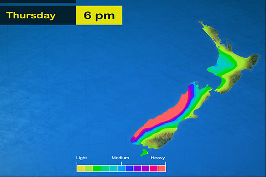
A band of very heavy rain is associated with this trough, which should move northwards during Wednesday and Thursday.
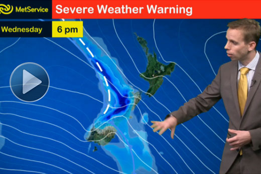
A severe weather watch has been issued for the Bay of Plenty.
The MetService has issued a severe weather watch for the Bay of Plenty.
In the ranges of the Eastern Bay of Plenty, a period of heavy rain is expected on Thursday night and during Friday.
The sun is then expected to brighten things up by the end of the weekend.
Meanwhile, a severe weather warning has been issued for parts of the South Island, with the heaviest falls likely around the Westland Ranges and Alps, where around 400-500mm could accumulate in a 24-hour period on higher slopes.
Around remaining parts of Westland, northern Fiordland, the Otago and Canterbury Headwaters away from the main divide, and the Buller and northwest Nelson ranges, around 150-250mm is expected during the same timeframe.
Although rain is expected to ease in Westland and Fiordland later on Wednesday, the flow is likely to remain north-west and further periods of heavy rain are possible into the weekend.

2 comments
damn it
Posted on 06-05-2015 16:47 | By NZgirl
And I washed the car today
damn it
Posted on 06-05-2015 16:47 | By NZgirl
And I washed the car today
Leave a Comment
You must be logged in to make a comment.