
UPDATED 9.32AM: The MetService has upgraded its severe weather watch to a warning for the Bay of Plenty as Tropical Cyclone Pam bears down on the country.
A severe weather watch remains in place for the Coromandel Peninsula.
Cyclone Pam's project path puts her hitting the East Coast around Monday morning.
Tropical Cyclone Pam, currently located near southern Vanuatu, is forecast to track southeastwards over the weekend and pass east of New Zealand during Monday and Tuesday.
There remains some uncertainty as to how close to the North Island the eventual cyclone track will be, however, it will likely be a significant event, with strong southeast winds and rain expected over much of the North Island late Sunday and Monday, along with extremely large seas about the east coast, says a statement from the MetService.
Around 200mm of rain is expected to accumulate in the ranges of Gisborne, northern Hawke's Bay and eastern Bay of Plenty, with lesser but still significant amounts near the coast.
Rivers and streams in these areas will rise rapidly and localised surface flooding and slips are likely as well as hazardous driving conditions.
"In addition, severe southeast gales are likely about Gisborne and Bay of Plenty for a time Monday, with gusts of 120 km/h in places but 160 km/h or possibly more about the eastern Bay of Plenty," says the weather organisation.
"Winds of this strength are likely to cause damage to trees and powerlines and could lift roofs and make for hazardous driving conditions.
"This is a developing situation and people are advised to stay up to date with the latest forecasts as further areas may be added to this Warning."
Earlier:
Tropical Cyclone Pam is still tracking southeast towards the northeast of New Zealand.
At 1am (NZ time) TC Pam was located about 70km east of Port Vila, Vanuatu.
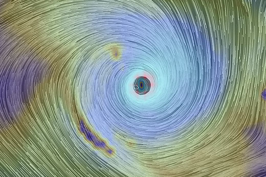
Pam sitting over Vanuatu. Image: earth.nullschool.net
The MetService says it's still a category 5 cyclone, and has intensified slightly overnight with the central pressure dropping to an estimated 899hPa and winds close to the centre of about 250km/h.
'The area of gales (65km/h winds) is estimated to extend up to 380km from the centre of the cyclone, affecting much of Vanuatu,” says MetService meteorologist John Law.
'TC Pam is still moving slowly south, and is expected to cross the southern Vanuatu islands of Erromango and Tanna during the next 12 hours while intensifying slightly.” The latest forecast track for TC PAM was issued by RSMC Nadi, Fiji at 2.24am.
The track shows that TC PAM is expected to take a southeast track to the northeast of New Zealand over the next couple of days.
'Although the tropical nature of the system will change as it moves south towards New Zealand, the cyclone will still remain a very intense storm, with heavy rain, severe gales and high seas associated with it,” says John.
'Please refer to the latest severe weather watches and warnings issued by MetService for more information on its possible impact on New Zealand's weather.”

1 comment
could be nasty
Posted on 14-03-2015 22:31 | By Capt_Kaveman
with warm summer air and fairly warm ocean temps of 22C around the BOP, if it tracks across the bay from Northland to East Cape we could be in for a bit of hell, been a long time coming but ill never forget the one around 74/75 which is still visible today in the dunes if you know where to look
Leave a Comment
You must be logged in to make a comment.