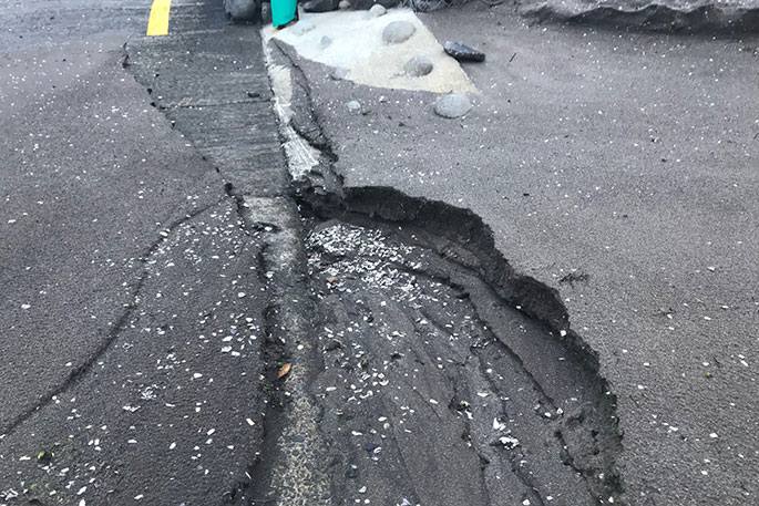
People are waking up this morning to survey any damage that last night's storm may have left.
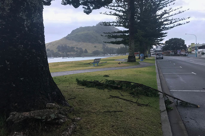
Apart from a few tree branches scattered around and some sand higher than it normally would be, Pilot Bay looks relatively untouched.
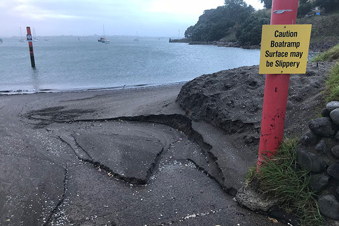
A reporter down there this morning says she spoke with a council contractor who was checking on the status of the Pilot Bay boat ramp.
"He was digging small squares at the Pilot Bay boatramp at 6.15am to see how much sand was on it.
"I think it was 500 tonnes?? of sand put down in Pilot Bay before Christmas, further along by the Waka Ama area. Nature does what nature does and the sand has moved along the beach and now moving off the beach.
"The contractor reckons it's not too bad on the ramp, with most of the sand near the bottom of the ramp. He says it's probably caused more from the recent king tides than the storm last night and that the ramp is firm enough for boats and trailers."
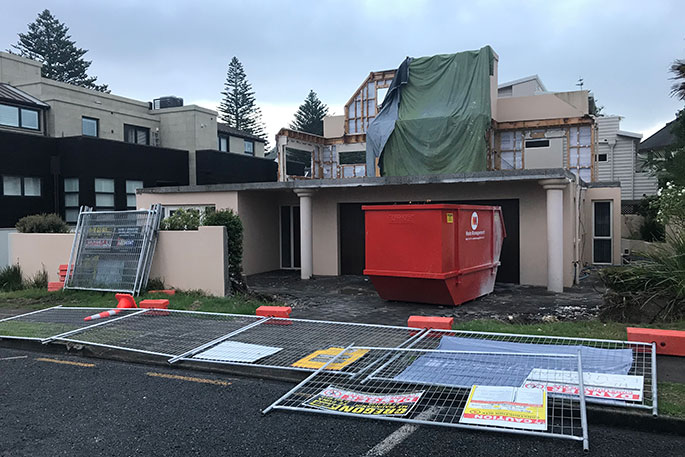
Temporary fencing around a house in Princess Ave was also blown over with last night's wind.
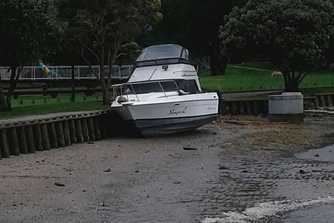
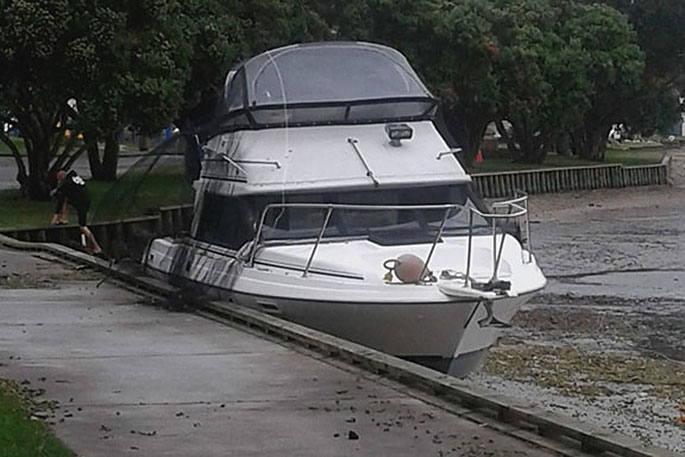
Photos emailed in from a SunLive reader shows a boat moored closer than normal to Memorial Park this morning.
In the Coromandel, Thames Coromandel District Council says the water supply to Hikutaia is out after the storm.
"We are working on getting this restored as soon as possible.
"There have been no reports of significant issues, or large volumes of incidednts, as a consequence of the weather event.
"All roads are open with no reports of flooding or slips at this stage."
The MetService still has a severe weather warning in place for both the Bay of Plenty and Coromandel.
A deep low is forecast to move southeastwards across central New Zealand on Friday delivering heavy rain and strong winds to northern and central New Zealand.
The heaviest rain is expected in Auckland, Coromandel Peninsula, Bay of Plenty, northern Gisborne, Mount Taranaki, Tongariro National Park, the Tararua Range, Marlborough, and Nelson.
The strongest winds are expected across the upper North Island, from Taranaki and Taihape to Bay of Plenty northwards, and a warning for severe gale northeasterlies is in force for these areas.
The deep low crosses central New Zealand on Friday bringing a period of west to northwest severe gales to the central and upper North Island, and gale southwesterlies across the lower North Island and eastern areas of the upper South Island.
The low is then forecast to move away to the southeast of the country on Saturday, and the winds and rain should ease.
People should keep up to date with the latest forecasts in case other areas are added to the WARNING.
Note, the Warning for heavy rain in Northland is now lifted.
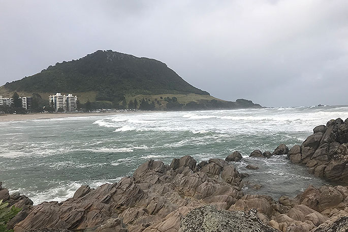
The scene at Pilot Bay this morning. Photos: Rosalie Liddle Crawford.
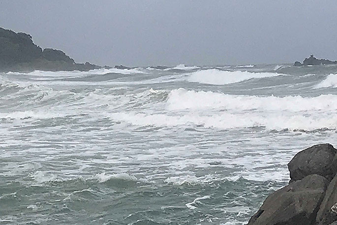
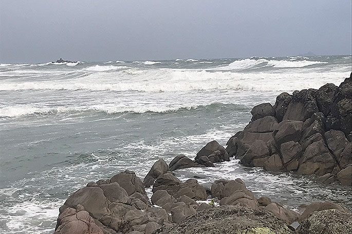
The scene at Mount Main Beach this morning.
It's high tide in #Tauranga- I used to have a beach here & room between the water and the bridge. @WeatherWatchNZ pic.twitter.com/L6QkONODOY
— annikakes (@annikakes) January 4, 2018
Heavy Rain Warning
Heavy rain may cause streams and rivers to rise rapidly. Surface flooding and slips are also possible and driving conditions may be hazardous.
Area: Auckland including Great Barrier Island
Valid: 3 hours from 9:00pm Thursday to 12:00am Friday
Forecast: Widespread heavy rain should ease tonight. A further 20-40mm rain may accumulate by midnight tonight, especially about the Waitakere and Hunua Ranges. Peak intensities of 15 to 25mm/hr possible.
Note, further bursts of heavy rain are possible during Friday.
Area: Coromandel Peninsula
Valid: 5 hours from 9pm Thursday to 2am Friday
Forecast: Heavy rain should ease in the early hours of Friday morning. A further 40-80mm of rain may accumulate, especially about the ranges. Peak intensities of 20 to 30mm/hr.
Note, further bursts of heavy rain are possible during Friday.
Area: Bay Of Plenty, Rotorua, Gisborne north of Ruatoria
Valid: 13 hours from 9pm Thursday to 10am Friday
Forecast: Heavy rain should ease west of Opotiki around 6am Friday, and further east by 10am. Expect 100-150mm of rain to accumulate about the ranges, while 70-100mm of rain may accumulate elsewhere. Peak intensities of 20 to 30mm/hr possible.
Note, further bursts of heavy rain are possible during Friday.
Area: Tongariro National Park
Valid: 27 hours from 9pm Thursday to 12am Saturday
Forecast: Periods of rain with heavy falls are expected from this evening (Thursday) through to Friday night. Expect 120-150mm of rain to accumulate during this time. Peak intensities of 15 to 25mm/hr.
Area: Mount Taranaki
Valid: 24 hours from 9pm Thursday to 9pm Friday
Forecast: Periods of rain with heavy falls are expected to continue through to Friday evening, then ease. Expect a further 100-150mm of rain to accumulate during this time. Peak intensities of 20 to 30mm/hr, and thunderstorms possible Friday afternoon and evening.
Area: Nelson
Valid: 12 hours from 9pm Thursday to 9am Friday
Forecast: Rain is expected to become heavy at times from this evening (Thursday) to mid-morning Friday. Expect 120-180mm of rain to accumulate about the ranges west of Motueka, while 50-80mm of rain may accumulate elsewhere. Peak intensities of 25-35mm/hr, especially about the western ranges.
Area: Marlborough including the Kaikoura Coast
Valid: 27 hours from 9pm Thursday to 12am Saturday
Forecast: Rain is expected to become heavy at times from this evening to midnight Friday. Expect 120-160mm of rain to accumulate about the Kaikoura Ranges, while 80-110mm may accumulate elsewhere, especially the Richmond Range. Peak intensities of 20 to 30mm/hr possible.
Area: Tararua Range
Valid: 24 hours from 9pm Thursday to 9pm Friday
Forecast: Rain is expected to become heavy at times from this (Thursday) evening to Friday evening, and 50mm may accumulate in 6 hours at times during this period.
Strong Wind Warning
Strong wind gusts could damage trees, powerlines and unsecured structures. Driving may be hazardous, especially for high-sided vehicles and motorcycles.
Area: Northland
Valid: 18 hours from 9pm Thursday to 3m Friday
Forecast: Severe gale northeasterlies gusting 120 km/h in exposed places should ease tonight (Thursday). However, northerlies are expected to rise to severe gale gusting 130 km/h in exposed places by dawn Friday.
The winds should change westerly around midday, possibly rising to severe gale gusting 120 km/h for a time, then winds ease Friday afternoon.
The combination of strong winds and high tides may also cause coastal inundation, especially in the east.
Area: Auckland including Great Barrier Island
Valid: 21 hours from 9pm Thursday to 6pm Friday
Forecast: From this (Thursday) evening, northeasterlies are expected to rise to severe gale gusting 120 km/h in exposed places, then turning northerly by dawn Friday and rising to severe gale gusting 130 km/h in exposed places.
The winds should change westerly around midday, possibly rising to severe gale gusting 120 km/h for a time, then winds ease Friday afternoon.
The combination of strong winds and high tides may also cause coastal inundation, especially in the east including the Firth of Thames.
Area: Coromandel Peninsula, Waikato, Waitomo, Taumarunui, Bay Of Plenty, Rotorua, Taupo, Taranaki, Taihape
Valid: 21 hours from 9pm Thursday to 6pm Friday
Forecast: From this (Thursday) evening until around dawn Friday, northeasterlies are expected to become severe gusting 120 km/h in exposed places, then from mid-morning Friday, winds turn north to northwesterly, severe gusting 120 km/h in exposed places. Winds should then ease Friday evening.
The combination of strong winds and high tides may also cause coastal inundation, especially in the east including the Firth of Thames.
Warnings no longer in force
Heavy rain warning lifted for: Northland: Further widespread heavy rain is no longer expected and the Warning is now lifted. However, showers are expected through to Friday afternoon, some possibly heavy especially in the west.

0 comments
Leave a Comment
You must be logged in to make a comment.