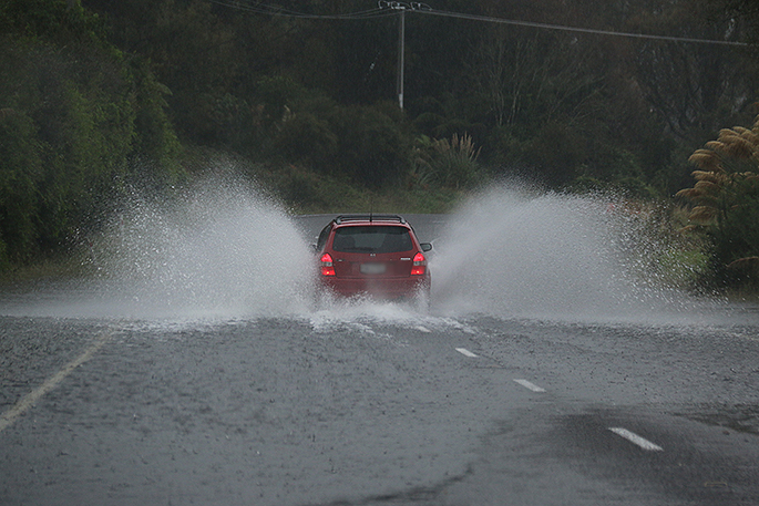
Severe Weather Warnings have been issued for many parts of New Zealand due to an incoming and rapidly deepening low.
It's a bit complicated because the low will be strengthening right up until early Friday when it arrives in the northern and western North Island - but by the end of Friday will already be weakening again, says WeatherWatch.co.nz.
'Timing is everything on whether or not wind will be a major issue with the low only "severe" for a fairly short time relatively speaking.
'For the most part we don't expect damaging winds but the angle of the wind (nor'east to start with) could work with rain and trees heavy with leaves to snap a few branches and cause a few power cuts. Those camping under and near trees should just double check their set up.”
WINDS The worst of the winds will be from late Thursday until Friday morning. Areas most exposed to severe gales will be marine areas and perhaps the western coastal side of the North Island, for example in places like the Manukau Heads which can be a wind tunnel for this type of set up. Also those directly near the centre of the low as it comes in.
Friday will be a blustery day for exposed parts of both islands. It will make camping a bit stressful for some but hopefully winds will remain below damaging for most others. In fact in many areas it will just be a bit of normal wind and rain.
'Damaging winds are possible near the centre of this low. The air pressure will fall to the low 970hPa range and we can't rule out it even dipping into the 960s,” says head forecaster Philip Duncan.
'This is incredibly low air pressure for northern NZ and it means the risks for severe weather are higher, even if localised and the weather isn't severe at your place.”
In the past similar lows like this have caused significant wind damage right near the centre, but only light winds just one region over.
Some may call it a 'fizzer' if it doesn't produce severe weather in your area but this isn't that type of low - instead it poses a risk to those most exposed to the centre of the low, which is anywhere from Taranaki to Northland nearest to the Tasman Sea.
'However the winds may also be very strong on the east coast for a time too as the low moves in and over land. It's a complicated set up so we advise you to check our wind maps to see how it will move through. Your local forecasts we have will also tell you percentage of rain and hourly wind directions can be found on our website.”
The centre of the low is expected to make landfall in the Taranaki region sometime on Friday morning with the winds tightly circulating clockwise around it. This means wind direction changes are highly likely.
RAIN: The worst of the rain will be late today and across Friday as the low tracks across the North Island. Rain will be patchy with light spits mixed in with more set-in heavy rain. Isolated heavier falls may also be slow moving and could lead to some flooding. Those camping and tramping around rivers and streams in the North Island and upper and eastern South Island should be aware of all the weather warnings and rain and wind maps. For the most part this low isn't too extreme but after such a long dry spell of weather and many Kiwis outdoors it's important to note that slips and flooding may occur with this low as it crosses the country from late Thursday to early Saturday.
DANGEROUS BEACHES The low will be creating dangerous rips and currents in popular beaches on both western and eastern coastlines and in both islands. Use your own judgment on conditions but boaties and swimmers should avoid the sea around the North Island from late today until Saturday.
Surfers will likely ignore this advice, so to them we say use common sense and be safe - it's quite a nasty system but swells and waves will be significant on both sides of the country for a few days.
SHOULD WE STAY CAMPING OR GO HOME? 'We often get asked this question and we rarely likely to wade in. It's almost part of a Kiwi Summer holiday to be stuck in a tent or caravan playing Monopoly and Last Card for several hours. Not everyone will have stormy weather, many campsites will just have a burst of wind and rain.
'Use your common sense, check your local spot, make sure any heavy rain won't flood you out or trap you (cutting off low lying flood prone roads). Some coastal areas may have storm surge (a higher than usual tide that combines with the low coming in).
'Check local warnings for your area, your local forecast and check the rain and wind maps we have at WeatherWatch.co.nz. Then you can make a safe decision. And remember this is short lived - it's moving away from NZ by Saturday so hopefully campers and trampers only have a short lived disruption.”
LOW BRINGS POSITIVES Despite some of the headlines this low will likely do more good than bad. While camp ground owners won't be overly impressed many farmers, gardeners, growers and those who rely on rain water will be doing backward flips due to happiness.
'We've seen a number of your tweets and comments over the past few days and there are a lot of happy New Zealanders about this low due to the much needed rain. Hopefully the low will weaken quickly on landfall and bring a decent soaking (without too much severe weather).”
As always WeatherWatch.co.nz will keep you posted as it moves through.
- Story by head forecaster Philip Duncan


0 comments
Leave a Comment
You must be logged in to make a comment.