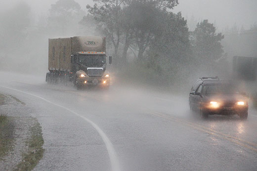
A heavy rain warning is in place for Bay of Plenty until late Monday, as the wet weather settles in.
The country experienced some contrasting conditions this week, with a settled start leading to a deep low-pressure system with associated fronts bringing rain to most of the country over the weekend.
Looking to the week ahead, the low-pressure system will weaken while tracking towards the North Island.
An associated front will bring more rain to the north and central areas, while the far south remains dry until another front is forecast to cross the area from the west on Tuesday.
The start of the week saw a ridge of high pressure bring settled conditions to most of the country. The capital experienced better weather than Auckland, as it was sheltered from the southwest flow which brought unsettled conditions to New Zealand's largest city.
As the week ended, so did the settled spell of weather as a low-pressure system from the Tasman Sea deepened and made its way towards New Zealand. The system then slowed down and an associated rain band extended over most of the country for the weekend. This brought periods of rain to the North Island and northern areas of the South Island, and the Nelson Ranges were flagged for warning amounts of rain well in advance.
'Since the early hours of yesterday morning places in the Nelson Ranges have seen over 200mm of rain, with heavy rain warnings in place there until 3am Monday morning,” says meteorologist Kyle Lee.
Next in line is the Bay of Plenty with a heavy rain warning in force for today through to Monday 6pm. While northern and central New Zealand have seen its fair share of wet weather, the far south has remained dry through the weekend with the sun providing a lovely day ahead for Southland and Fiordland especially.
This coming week the unsettled weather will continue for the North Island. The low-pressure weakens and tracks towards it while the far south continues to have a settled start to the week ahead of another frontal feature expected to bring more rain to the country on Tuesday.
However, the front will be fast moving and will give way to a ridge of high pressure for much of Thursday with a break in the wet weather for most in sight.

0 comments
Leave a Comment
You must be logged in to make a comment.