The large and deep low pressure system approaching New Zealand is complicated to forecast due to so many moving parts, says WeatherWatch.co.nz.
"We've done our best to identify what the key issues will be each day and where."
With such a large low more fine tuning will be needed over the next 48 hours.
THE GENERAL SET UP:
THURSDAY: Sub-tropical northerly winds and rain moves in on Thursday with heavy falls in the north and west of both islands. Winds will be strong, possibly gale in some places, but likely below damaging.
FRIDAY: Colder south easterlies arrive in the lower South Island on Friday (especially Canterbury & Otago) with heavy snow developing above a few hundred metres and heavy rain at sea level. Showers and mild nor'westers continue for the North Island with overnight snow possible in Central Plateau.
SATURDAY: Wintry, windy, south easterlies from Canterbury to Hawke's Bay with winds possibly severe gale again through Cook Strait. Easing elsewhere and becoming sunny/dry.
Severe Weather Risks around NZ until Saturday: With such a large low they operate quite differently to, say, a tropical storm which has all the worst wind and rain near the very centre. With these large lows that develop around New Zealand the centre can actually be quite calm and sizeable - so as they low crosses over some areas will be calm and dry.
Our mountains and ranges also play a huge role at increasing or decreasing winds and rain.
The energy with this system is significant but thankfully it is spread out over a greater distance and this reduces the severity - and also places a big chunk of severe weather out at sea.
HEAVY RAIN/SNOW:
THURSDAY
- North Island: Heavy rain develops in the north of the North Island (highest risk looks to be Bay of Plenty to East Cape to Waikato/Central Plateau areas - but all upper North Island areas are at risk. Heavy rain eases later in the day or by midnight.
- South Island: Heavy rain pushes into Nelson and maybe Marlborough, then the West Coast before crossing the mountains and into Otago (this is because the centre of the low will cross over the South Island). The mountains will alter the rain clouds so it's hard to lock in too much more detail this far out just yet. Snow levels will lower overnight.
FRIDAY
- South Island: Heavy rain with a cold southerly spreads up Otago and slowly through Canterbury, fall to snow above a few hundred metres (we'll lock in the general snow level closer to the time). While snow may not fall as low as it did last week there is more moisture for the South Island so snow amounts may be considerable at higher elevations, especially the eastern Canterbury ranges.
- North Island: A few isolated downpours/showers here and there.
SATURDAY:
- North Island: A narrow burst of heavy rain slides northwards up the east coast, affecting Wellington, Wairarapa in the morning then drifting into Hawke's Bay and weakening.
- South Island: Showers ease/clear.
GALES/SEVERE GALES: With this low pressure so large there is some good news on the wind front - the bulk of the gales will be out at sea, surrounding New Zealand but mainly avoiding land. There are some risks, which we'll update and fine tune each day:
THURSDAY:
- A burst of northerly winds accompanying the main North Island band of rain may see some gales, but generally below damaging threshold. Winds most likely in the north and north east of the North Island. Strong NE winds may also hug the South Island's West Coast but again damaging winds not expected at this stage.
FRIDAY:
- Winds pick up now for the south - Severe SE Gales are possible along the Otago and Canterbury coastlines, moving at night northwards towards Cook Strait area.
SATURDAY:
- A burst of severe S to SE gales is again possible through Cook Strait, brushing Wellington and Wairarapa and coastal Marlborough. Taranaki may also be blasted by the SE gales. These winds ease by Saturday evening.
POTENTIAL TRAVEL ISSUES: THURSDAY:
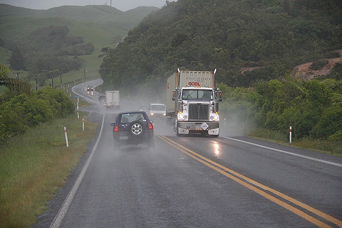
- Rain may cause some issues (slips and flooding possible) for Highways in the upper half of the North Island.
- Winds shouldn't be an issue for most, but some smaller aircraft may face delays in smaller airports (like Gisborne or Tauranga as an example)
FRIDAY:
- Rain may cause some issues (slips and flooding possible) for Highways in the eastern South Island.
- Snow at higher elevations may impact most Alpine Passes. Snow may also impact SH1 the Desert Road overnight Friday and into Saturday.
- Severe Gales may affect flights in Otago, Canterbury and later Marlborough and Wellington airports. Motorists may be impacted on SH2 over the Rimutaka Ranges for a time overnight too.
SATURDAY
- Severe Gales may delay or cancel flights in Wellington early in the morning. Check our daily updates for more details. Motorists may be impacted on SH2 over the Rimutaka Ranges for a time in the morning.

0 comments
Leave a Comment
You must be logged in to make a comment.