As the weekend approaches rain clouds are gathering over the Tasman Sea, so if you have outdoor activities planned make sure your wet weather gear is close to hand.
On the heels of the rain, a change to southerlies will see temperatures plummet as we head into the new month of May.
A ridge of high pressure, which has brought settled weather to much of the country this week, slides away to the east today and Friday as a trough over the Tasman Sea moves onto New Zealand.
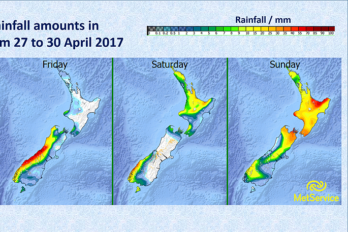
A period of rain is expected for northern and western parts of the country ahead of this trough, and northwest gales are likely in southern and central parts of New Zealand on Friday.
'Almost all should get rain at some stage over the weekend, and places in the north and west will likely see the largest accumulations,” says MetService Meteorologist Peter Little.
'Severe Weather Warnings and Watches for heavy rain and strong winds have been issued for several regions.”
Currently lurking over the Southern Ocean, a front followed by a strong southerly change sweeps up southern and central New Zealand on Sunday, and then the remainder of the country on Monday, bringing colder temperatures and a period of rain to southern and eastern areas.
'After a recent run of temperatures in the high teens, the forecast high for Invercargill on Sunday is just 12 degrees. In addition, snow could affect some of the higher South Island roads for a time on Sunday, so people travelling home from their holidays for the start of the new school term should factor this into their travel plans.”
You can check the status of the roads and any closures via the NZTA website

0 comments
Leave a Comment
You must be logged in to make a comment.