People are being warned to brace for a busy weather week, starting with a deepening sub-tropical low brushing New Zealand from the north east and ending with a Tasman Sea low and cold front(s) moving in this coming weekend.
'Despite the rough weather offshore it may be much calmer over land this week thanks to high pressure,” says WeatherWatch.co.nz
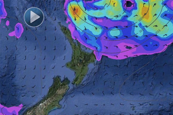
'The sub-tropical low (which we will have more details about in our weather video update this afternoon) may create dangerous beach conditions along our north eastern beaches from Northland to Coromndel Peninsula, Bay of Plenty to East Cape and maybe as far south as Mahia Peninsula.”
Even if the weather is lovely, sunny and mild at the beach please be aware there is a significant low pressure system well offshore which will help create dangerous rips, stronger currents and larger waves at some of our most popular beaches.
'Of course a general warning to everyday-beach-goers to take extra care is usually a green light for surfers to head out.
'High pressure slowly crosses the country this week, helping guide the sup-tropical low away from New Zealand continuing a pattern of mainly dry weather over us.”
By the end of the week, expect warmer north to north west winds to develop ahead of what could be a messy weekend with a mix of rain, showers, gusty winds and warm sunny weather too as a classic Autumn system approaches Aotearoa from the west.
'We'll have more details on this once we get past ANZAC Day...and speaking ANZAC, the forecast for dawn ceremonies looks dry basically everywhere - just the risk of a shower in the east of the North Island but even there the forecast is still for a mainly dry day.”
- WeatherWatch.co.nz

0 comments
Leave a Comment
You must be logged in to make a comment.