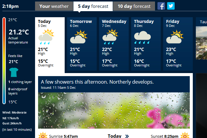
With the arrival of summer, temperatures are gradually getting warmer and many places around New Zealand got a glimpse of barbecue weather over the weekend.
This little taste of summer saw Gisborne reach 24.6C on Sunday, and Marsden Point just south of Whangarei got to 24.5C, with more warm temperatures forecast for the week ahead.
'The heating of the land today will activate inland convective showers over the North Island, with the possibility of the odd severe thunderstorm and downpours of 25-40mm/hr in some areas,” says communications Meteorologist Lisa Murray. Meanwhile, the South Island remains mostly dry. This week the biggest weather event will be coming from the Tasman Sea in the form of a slow-moving wet and windy front.
This front arrives on the shores of Fiordland Tuesday morning and spreads north bringing heavy rain to Westland and Buller on Wednesday. 'The strong northwesterly winds ahead of this front affect central New Zealand on Wednesday,” says Lisa.
'The front then sails up the rest of the Island on Thursday, doing its best to water gardens throughout the North Island.” Lisa advises the public in the west and central regions of the country to keep up to date with forecasts and heed MetService's Severe Weather Warnings and Watches as they are issued for this event. The latest severe weather updates can be found at http://info.metraweather.com/e/60812/warnings-home/bzd7rp/465912880.

0 comments
Leave a Comment
You must be logged in to make a comment.