A front has been making its way up the country, bringing rain to most regions as it moved over the country.
While some places did experience heavy rain with this front, it was only brief, says a statement from the MetService.
Inglewood in Taranaki received 11mm of rain in one hour early Sunday morning, and Palmerston North received 18.4mm of rain over two hours.
This front is expected to linger over the upper North Island on Monday and gradually weaken, bringing occasional rain to these areas.
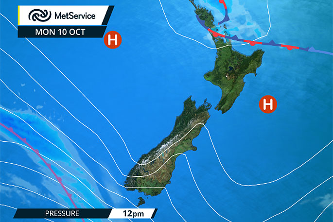
Further south, while a ridge of high pressure will bring dry weather on Monday as the kids go back to school, MetService are already warning of the next front approaching. 'Another front is approaching New Zealand from the southwest, with heavy rain reaching Fiordland on Monday evening,” says MetService Meteorologist Claire Flynn.
The front is expected to move northeastwards up the country during Tuesday and Wednesday, bringing a period of rain to most people, and this will not be the end of the changeable weather.
A low pressure system is then expected to approach New Zealand on Thursday, bringing further unsettled weather for the end of the week.
Spring is a wild ride! Series of fronts racing across the country, some fine spells South Is. on Fri+Sun, North Is. on Sat. ^TA pic.twitter.com/mxWAyekU22
— MetService (@MetService) October 5, 2016

0 comments
Leave a Comment
You must be logged in to make a comment.