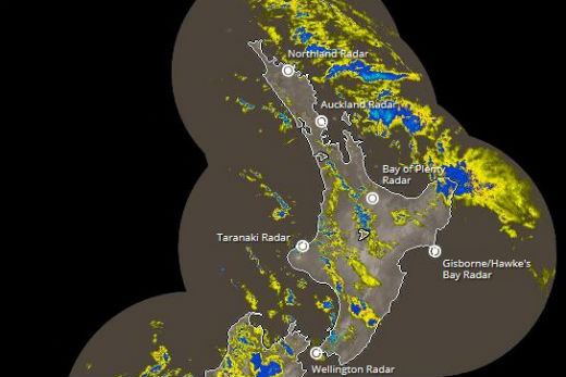
After being buffeted with heavy rain and wind last night Bay of Plenty and Coromandel Peninsula can expect more says the MetService.
The MetService have issued another severe weather warning for the two regions.
Image: MetService.
A media release this morning says heavy rain in the west of the South Island will ease this afternoon or evening. While severe northwest gales about central New Zealand are easing but should continue about the Chatham Islands until Monday morning.
An active front that passed over New Zealand has left a strong west to northwest airflow over much of the country including the Chatham Islands.
Heavy rain has been falling in the west and north of the South Island, but is expected to turn to showers today with squally thunderstorms. A rainfall warning remains in Westland, Buller and western Nelson until this afternoon or evening.
People in these areas are advised that this amount of rain will cause rivers and streams to rise rapidly and may cause slips and surface flooding.
Although the wind has eased slightly in many places, a warning for severe gale north-westerlies remains for Wellington, Wairarapa, the Marlborough Sounds and Chatham Islands.
These winds have the potential to be damaging, particularly to trees, powerlines and unsecured structures and also make for hazardous driving conditions, especially for tall sided vehicles and motorcycles.
Also, heavy swells and large waves are expected to affect western coasts and may cause coastal erosion in vulnerable areas and make driving conditions hazardous about low-lying coastal roads.
The MetService forecast for Tauranga this afternoon is for a chance of evening showers and strong westerlies with a high of 18C and an overnight low of 10C. Tomorrow the MetService expects a chance of morning showers, otherwise fine with the westerly to die off. While that's a positive the temperature is only expected to get to a high of 15C with an overnight low of 6C.

0 comments
Leave a Comment
You must be logged in to make a comment.