Cold weather is spreading across the country this week to mark the start of the meteorological winter on June 1.
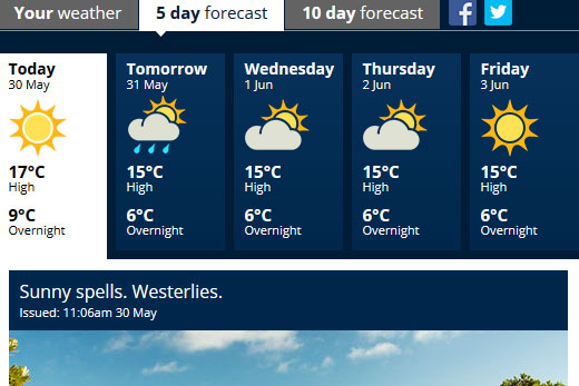
Temperatures in the Bay are set to sit around the 15 degree mark during the day, before dropping down to six degrees overnight.
Overnight lows of six degrees are being predicted for the region. Image: MetService.
These cold temperatures are being brought about by the predicted snow showers and severe frosts which are on the cards for parts of the South Island, but things are looking up for the long weekend as an area of high pressure moves in. A cold and showery southwesterly flow is bringing showers to most of the country during the next few days.
Cantabrians woke up to below freezing temperatures in Timaru and Methven this morning, with parts of Marlborough and Otago also dropping to negative numbers.
As temperatures continue to decline this week, snow levels will start to lower.
'We are forecasting snow showers to fall as low as 300 metres in the far south on Tuesday, and to around 400 metres in Otago and Canterbury,” says meteorologist Emma Blades.
'Snow to this level could cause problems on the higher passes, some of which we have already issued snow warnings for, so I recommend checking the latest forecast before heading out.”
In the clearances between the snow showers, there will also be some frosty mornings for the central North Island and much of the South Island. Severe frosts are likely in Central Otago with temperatures forecast to drop to around -8C in chilly spots like Pukaki. Mid-week a ridge of high pressure starts to build, bringing clear skies to most of the country.
'Most New Zealanders will see plenty of sunshine this long weekend. However, clear skies do mean very cold temperatures overnight, with even Auckland forecast to drop to around 6C mid-week,” says Emma.

0 comments
Leave a Comment
You must be logged in to make a comment.