A weak ridge extends across New Zealand means the warm summer weather will continue for a few days.
However, it is briefly interrupted by a cold front that is moving briskly up the South Island, reaching Cook Strait tonight and then quickly dissolving.
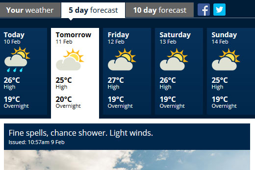
Fine weather with isolated showers is in the forecast for the region this week. Image: MetService.
'Wellington is still waiting for the first rainfall in February,” says MetService Meteorologist Lisa Murray, 'and this southerly is not going to deliver enough to help the drying grass in the parks about the region.”
The ridge brings settled weather across many parts of the country, although there is moisture trapped under this ridge showing up as cloud in the morning and late evenings.
The afternoons are looking good with everyone getting to see blue sky at some stage this week.
The fine weather looks set to extend through to the weekend in the Bay, with temperatures sitting around the 25-27 degree mark during the day, and around 19 degrees at night.
Lisa says if people are looking for some rain to water the garden, their best chance this week will be if they are lucky enough to be under one of the isolated showers that pop up inland, with a chance of a heavy shower for Northland and Waikato today.
Further afield, there are two tropical depressions being monitored in the Tropics.
The first (TD09F) lies between the Solomon Islands and is expected move slowly southeast today with the potential to deepen between Vanuatu and Fiji into a tropical cyclone towards the end of this week.
Another depression south of the Solomon Islands may also deepen this week. Both of these lows are being monitored closely by MetService.

0 comments
Leave a Comment
You must be logged in to make a comment.