The MetService is forecasting rain for the Bay and Coromandel as Cyclone Ula moves towards New Zealand.
As of last night, Tropical Cyclone Ula, currently a category 4 cyclone, was situated east of New Caledonia.
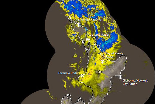
Wet weather is being forecast for the top half of the North Island. Image: MetService.
It was forecast to move southwards today while weakening.
Tropical Cyclone Ula will be situated 500 – 600 km north of Cape Reinga by the end of today.
'While TC Ula will remain well north of New Zealand for the next few days, humid air coming down from the tropics ahead of it will cause some rain during Tuesday for most of the North Island except the most southern parts,” says MetService meteorologist Claire Flynn.
'While this rain could be heavy at times for a few places in the north, rainfall accumulations are not expected to be unusually large.”
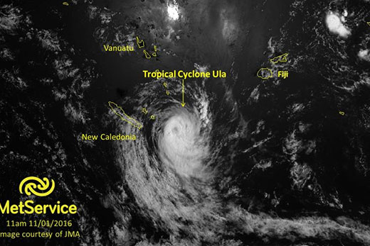
Satellite image showing Cyclone Ula sitting near New Caledonia yesterday morning.
Rain should clear for most places in the North Island by the end of today. For the South Island, a cold front is expected to approach from the south late on Tuesday. Eastern areas can expect fine weather and temperatures in the mid to late twenties on this afternoon.
However, the cold front will bring rain to the west and showers to the east as it moves northwards on this evening and Wednesday morning.
Southerly winds behind the front will mean that Wednesday will be much cooler for eastern areas, with temperatures in the mid to late teens.
On Wednesday, a ridge of high pressure begins to build across the whole country, bringing settled weather, before beginning to move away on Thursday. Another cold front then approaches from the south on Friday.

0 comments
Leave a Comment
You must be logged in to make a comment.