The wet weather seen in the Bay this morning is expected to clear to make way for fine spells today.
The MetService is forecasting occasional morning drizzle to be followed by fine spells, and northeast winds.
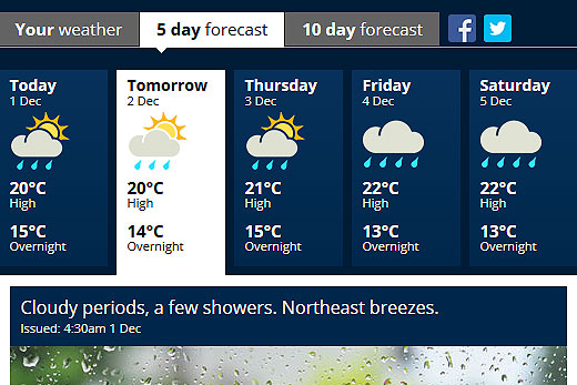
Warm, moist northwesterlies are generating hot temperatures, along with patchy rain this week. Image: MetService.
Today's temperature is expected to reach around 20C, with an overnight low of 15.
Tomorrow is looking pretty much the same, with cloudy periods and a few showers.
The last weekend of spring brought warm temperatures to the North Island, with Napier getting the top temperature for a town or city of 29C on Saturday.
A lot of places stayed dry for the majority of the weekend, but some caught the odd heavy shower, with Whangarei and Tauranga both recording 10mm in one hour on Saturday afternoon, says meteorologist Emma Blades.
The central and lower North Island was expected to reach temperatures that were well above the average for this time of year.
'Temperatures around reached 25C in the northern Wellington region yesterday afternoon,” says Emma.
'Eastern and southern parts of the South Island will see their temperatures climb today, with locations in Canterbury and Central Otago possibly getting into the thirties.”
The warm, moist northwesterlies that are generating these temperatures will also bring plenty of cloud and patchy rain to most of the country over this week.
As usual in these northwest flows, eastern areas will only see a sprinkling, but the west of the South Island is likely to receive significant rainfall on Tuesday through to Thursday.
Emma says temperatures return to normal by the end of the week as the rain gradually moves up to the top of the North Island.
Meanwhile, another rain band reaches the bottom of the South Island on Friday, before travelling north on Saturday.

0 comments
Leave a Comment
You must be logged in to make a comment.